Samuel Tonucci
Geography + Urban Planning
About Me
I am a recent Geography graduate and FAA Part 107 certified pilot specializing in Human Urban Economics, with a passion for understanding how cities evolve and function. By combining technical proficiency in GIS and photogrammetry with drone data collection, I bridge the gap between high-level urban theory and actionable spatial data. I leverage aerial technology to bring a unique perspective to urban development and design, ensuring that modern planning is both data-driven and visually informed.
Resume
Here is my education, work experience, & some skills I've got.
Experience
Non-Profit, HCC
Media Production Specialist
January 2021 - Present
As a Media Production Specialist at HCC, I manage the comprehensive oversight of digital media and live broadcasts. Beyond technical production, I specialize in the planning of site operations, including location scouting, permit negotiation, and FAA Part 107 flight coordination. My role requires regulatory oversight, ensuring all third-party content is properly licensed and that operations, both on the ground and in the air, comply with regulations and requirements on a case by case basis
Education
University of Cincinnati
BA - Geography
December 2025
Bachelor of Arts in Geography with a focus in Human Urban Economics
University of Cincinnati
Certificate - GIS
December 2025
Certificate in Geographic Information Systems
University of Cincinnati - DAAP
Certificate - Urban Planning
December 2025
Certificate in Urban Planning through the College of Design, Architecture, Art, and Planning
Skills & Expertise
Projects
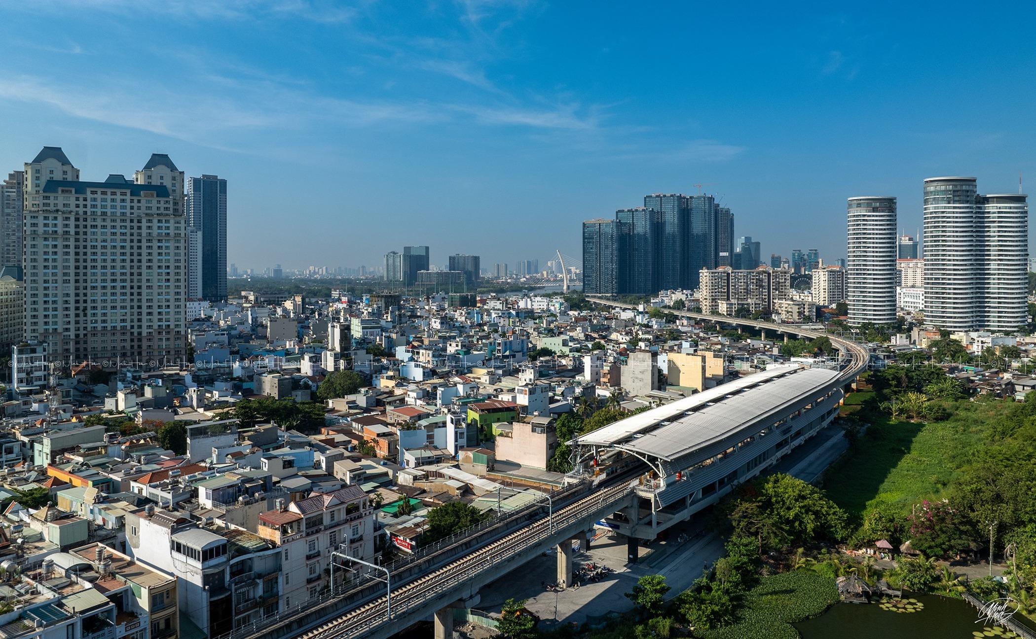
Future Ready TOD Audit - Phuoc Long Station
Exploring a high-priority "pilot" TOD location and evaluating the first-mile/last-mile connectivity and flood resilience of the 500m catchment area around Phuoc Long Station, Thu Duc City.
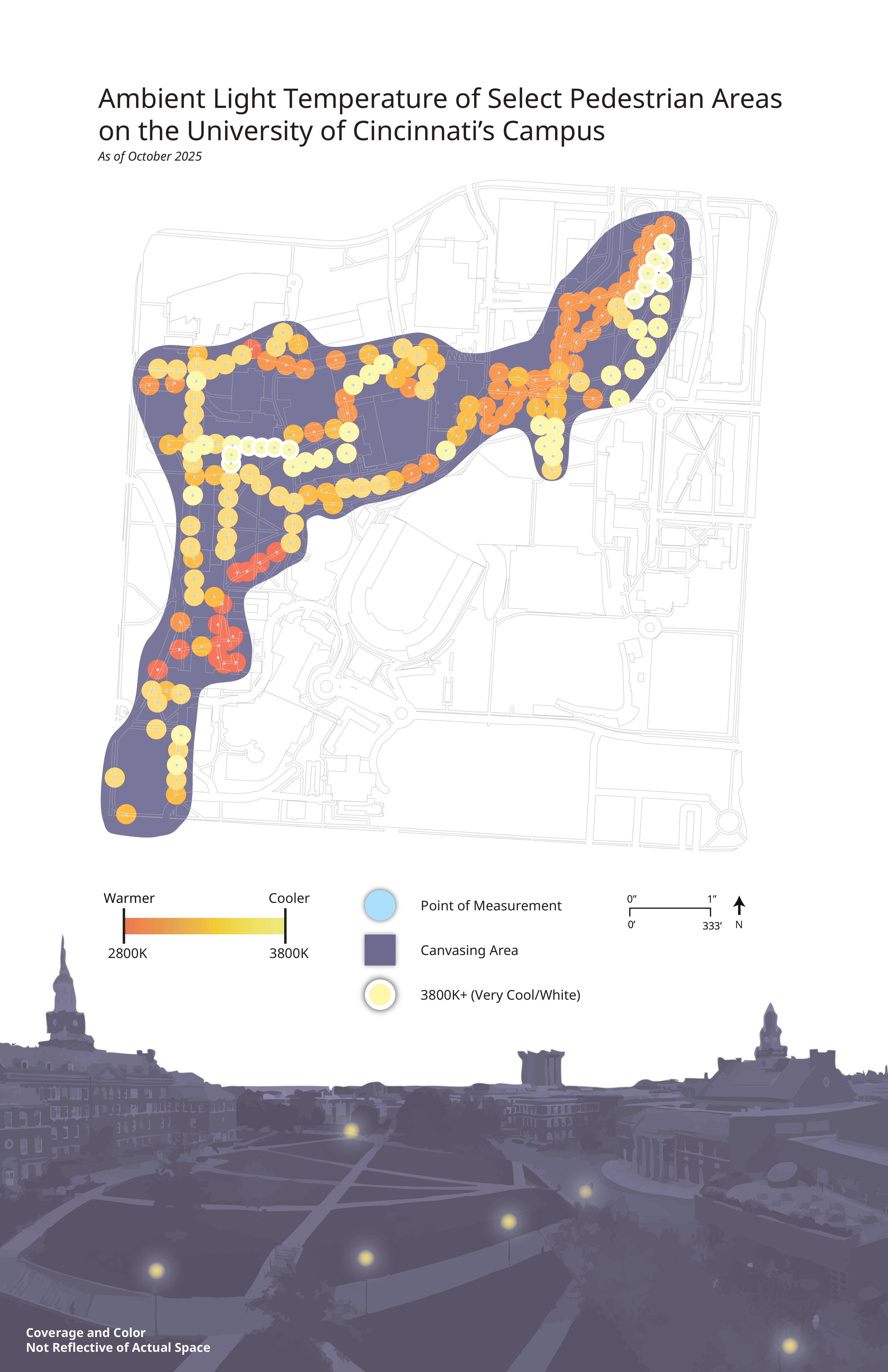
Ambient Light Temperature Mapping
Collected and processed light temperature readings around University of Cincinnati. Used geotagging data to map readings. Packaged findings and imagery in a Visual Essay
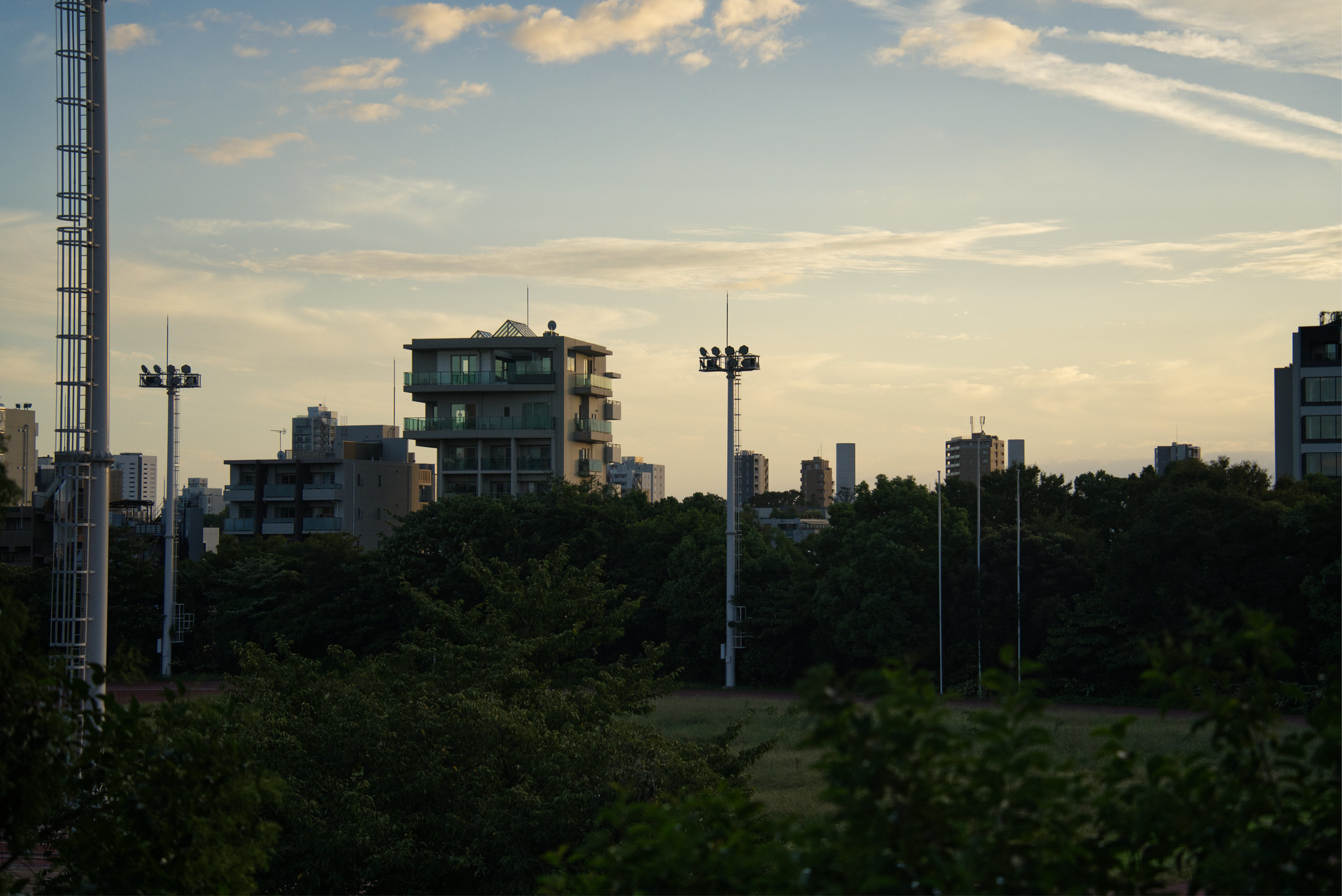
Green Master Plan (Nagoya, Japan)
Conducted on-site research of urban green space and land use policy in Nagoya, Japan. Compared policies to smaller cities and international contexts, creating recommendations for adaptation abroad.
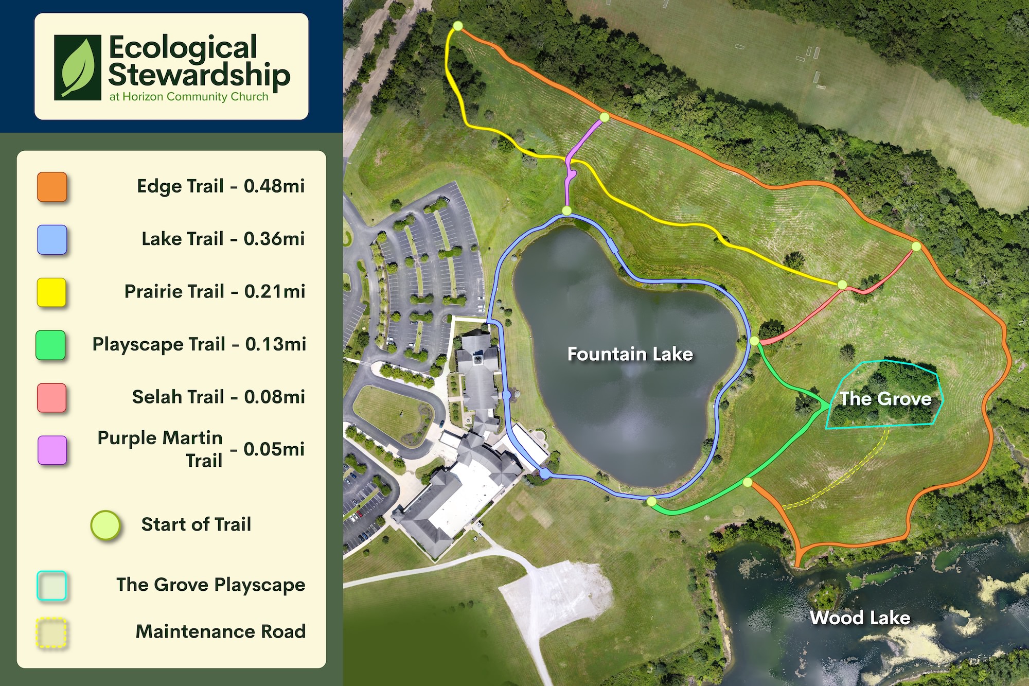
Geospatial Site Surveying & Orthomosaic Mapping
Collected aerial drone imagery and processed high-resolution maps. Produced trail map for ecological stewardship team for use in public green space.
Promotional Video
Shot and edited a promotional video for use with Ecological Stewardship Project as a means to promote engagement along with produced graphic materials